– With Files from My Lethbridge Now staff
Update: 1:10 p.m.
Jasper National Park has provided its latest update which details some of the damage to the town.
Assessments of infrastructure damages is ongoing. The damage within the townsite is estimated at around 30%. Out of a total of 1113 structures within the town, 358 have been destroyed.
— Jasper National Park, Parks Canada (@JasperNP) July 26, 2024
154 firefighters are patrolling the outskirts of the town to extinguish hot spots, and “all critical infrastructure was successfully protected.”
They said this includes the hospital, emergency services building, schools, activity centre and wastewater treatment plant.
Original Story: 10:20 a.m.
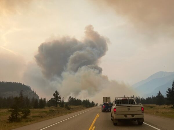
The most significant damage from the wildfires in the Town of Jasper is said to be on the west side, southwest of Miette Avenue.
According to Parks Canada, as of 4:30 p.m. yesterday, all critical infrastructure in the community has been protected including the hospital, emergency services building, the schools, the activity centre and the wastewater treatment plant. However, some homes and businesses have been lost.
“Firefighting efforts have prevented significant damage to much of the infrastructure in the east end of town. Our priority remains protecting structures that have not yet been impacted by fire,” says Parks Canada.
According to the update, access to Maligne Lake and Highway 93 will see delays, as several bridges throughout the Town and park have been damaged, including The Moberly Bridge and the Old Fort Point Bridge. Structural damage on the bridges on the Icefields Parkway will also need to be assessed.
The Jasper Fire Complex is estimated to span roughly 36,000 hectares. Parks Canada has released a map showing what they estimate to be the perimeter of the complex, which is made up of multiple fires in the area, including what was originally named the North and South wildfires and the Utopia wildfire near Miette Hot Springs.
Even though an estimated perimeter has been released, those looking at the map are being reminded wildfire activity throughout the 36,000 hectares varies and does not represent any damage that has happened or what the level of damage is to property or infrastructure.
According to officials, the perimeter shown on the map is a reference because it is a best estimate based on satellite imaging and what crews have been able to see from the ground.
“Aircraft have not been able to fly safely and today satellite imaging was obscured by thick cloud cover,” the Thursday night update reports. “Future maps will change when we can map the perimeter from the air.”
According to the update, Thursday there was minimal fire activity or spread, with officials crediting the 10-15 mm of rainfall that fell the previous night. It is anticipated this moisture will keep fire behaviour low for the next 72 hours, time which crews will be taking advantage of to suppress the wildfire and reduce further spread.
Today, officials will be reassessing the Utopia fire, which is said to have been close to being held before the North and South fires started.
As crews continue to battle the fires in the Jasper Complex, Albertans continue to support those who have been evacuated by the fire.
During Thursday’s update from the province, Minister of Public Safety and Emergency Services Mike Ellis said, “we are bearing witness” to the power of community in the province. While communities like Calgary, Edmonton and Grande Prairie host those evacuated by the wildfires, others are looking for ways to offer support.
Two ways Albertans can support evacuees include donating to either the Canadian Red Cross or the Jasper Community Outreach Teams Caring Community Fund.
Something going on in the Prince George area you think people should know about?
Send us a news tip by emailing [email protected].


